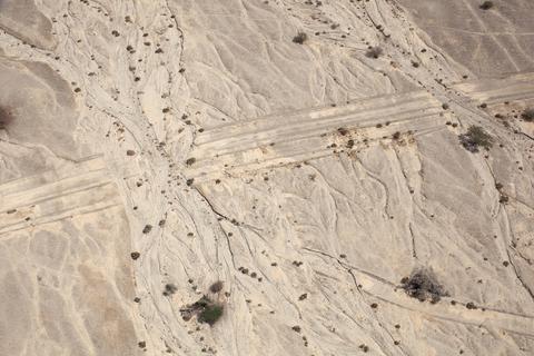
LATITUDE: 30°52'27"N / LONGITUDE: 35°16'1"E, October 9, 2011. Marks of passage and erasure along the historic north–south travel route. Once the main route to Eilat, the track now runs alongside Highway 90 and is still used by heavy vehicles, including bulldozers and military convoys. The white calcareous sediment and beds of salt and gypsum that make up the surface create a silt-like terrain that records the tire tracks. This particular section shows portions that have been washed away by flooding coming from the direction of the ancient Dead Sea tributaries., from the series Desert Bloom
Artist: Fazal Sheikh (American, born 1965)
Technical metadata and APIs
- IIIF
-
The International Image Interoperability Framework, or IIIF, is an open standard for delivering high-quality, attributed digital objects online at scale. Visit iiif.io to learn more
- Linked Art
-
Linked Art is a Community working together to create a shared Model based on Linked Open Data to describe Art.